
EV Planning Resources: Charging and Energy Needs
This section compiles resources and tools for EV infrastructure planning and implementation. Resources are organized by subject area and are labeled with resource type—namely, calculators and software, datasets and maps, and additional guidance and reference.
Electric Vehicle Infrastructure Projection Tool (EVI-Pro) Lite
DOE - Calculator/Software
Web app to help estimate the amount of EV charging a State (or alternatively, a specific urban/suburban area) needs to support a user-supplied number of plug-in EVs. Reports the number of Level 2 and DCFC plugs needed and (for urban/suburban areas) graphs a weekday electric load profile. Provides statistics on the current amount of charging plugs and EVs in the State or region as reference numbers. Note: May be most useful for State-level planning.
Access the Electric Vehicle Infrastructure Projection Tool (EVI-Pro) Lite.
Access the EVI-X Modeling Suite
Alternative Fueling Station Locator
DOE - Dataset/Map
Interactive web map containing all alternative vehicle fueling stations in the United States and Canada, including EV charging stations. Users can filter by charger and connector type, public or private access, owner type, and possible payment methods and can download the underlying data.
Access the Alternative Fueling Station Locator.
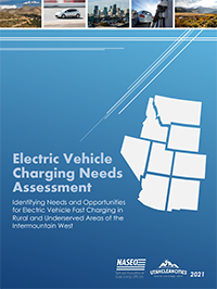
Electric Vehicle Charging Needs Assessment
NASEO – Guidance/Reference
A report on key barriers and opportunities for investment in EV infrastructure in the Intermountain West. Includes analysis and findings based on a questionnaire issued to EV stakeholders in eight States. The appendix summarizes current EV infrastructure gaps, the questionnaire responses, and opportunities for each individual State.
Access the Electric Vehicle Charging Needs Assessment.
National Park Service EV Charger Gap Analysis Tool
USDOT Volpe Center – Calculator/Software
Python script that identifies and visualizes gaps in EV charging coverage along a route between a user-specified origin and destination. Developed to identify gaps between national parks and key population centers, but can be adapted to other contexts. Note: This tool requires ArcGIS Pro and purchasable ESRI credits.
View the Electric Vehicle Charging Gap Analysis: Summary Memo and Instructions for Automated Tool and contact Andrew Breck to request the tool script.
Regional EV Charging Infrastructure Location Identification Toolkit (ILIT)
M.J. Bradley & Associates – Calculator/Software
A collection of tools to assess the suitability of potential DCFC sites in the Northeast, Mid-Atlantic, and Southeast States from North Carolina to Maine. The tools include the Excel-based ILIT Model to identify and rank candidate locations based on user priorities, the online Results Mapper to analyze and visualize the candidate locations, and the online Data Viewer to overlay and explore geographic information system data layers with different economic, demographic, and environmental metrics.
Access the Regional EV Charging Infrastructure Location Identification Toolkit (ILIT).
Southeast Regional Electric Vehicle Information Exchange (SE REVI)
National Association of State Energy Officials – Dataset/Map
Interactive web map with information on EV infrastructure planning, policy development, and program implementation in the Southeastern region of the U.S. (Alabama, Arkansas, Florida, Georgia, Kentucky, Mississippi, North Carolina, Puerto Rico, South Carolina, Tennessee, and the U.S. Virgin Islands). This map was designed to help coordinate EV infrastructure planning and identify charging station gaps. Users can turn layers on or off as needed.
Access the Southeast Regional Electric Vehicle Information Exchange (SE REVI)
UC Davis GIS EV Planning Toolbox for MPOs
UC Davis Electric Vehicle Research Center – Dataset/Map
Interactive map designed to help plan the location of EV charging infrastructure. Note: Datasets are only provided for California. Users are also required to have ArcView or ArcGIS to run the tools.
Access UC Davis GIS EV Planning Toolbox for MPOs