
INSIGHTS Project
![]()
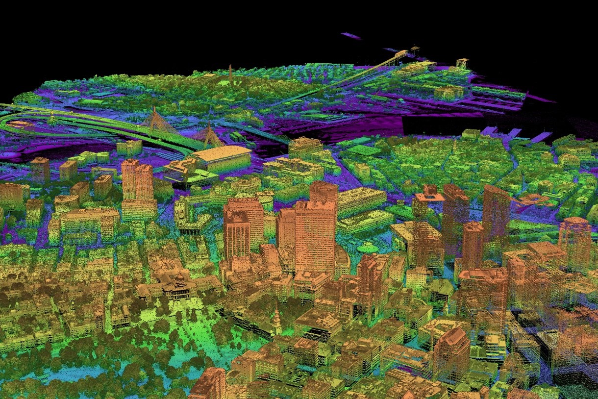
(Image by MIT Lincoln Laboratory)
The Infrastructure Systems Insights through Geospatial-sensing for Holistic Transportation Solutions (INSIGHTS) project is ARPA-I’s first step towards enabling development of practical, cost-effective, continuously updated digital models of America’s infrastructure at scale, including streets, highways, ports, rail lines, airports, and pipelines.
These models, also known as digital twins, have the potential to unlock new capabilities and cost savings for the entire transportation system. With these technologies, state and local transportation owners and operators could identify every dangerous intersection and roadway segment across their entire network, ensure construction sites would not be shut down over a breached utility or cut cable, develop dynamically-planned evacuation routes with one click ensuring families can safely escape violent storms and wildfires, and provide underlying models of our infrastructure that could enable higher degrees of autonomy for aircraft and surface vehicles. These are just a few of the possibilities that at-scale knowledge and insight of our infrastructure systems could unlock.
In a first of its kind partnership with MIT Lincoln Laboratory, the Utah Department of Transportation, the Colorado Department of Transportation, Salt Lake City, the Denver Regional Council of Governments, and US DOT’s Volpe Center, ARPA-I’s INSIGHTS project will explore the use of advanced aerial LiDAR to build digital models of transportation infrastructure, and create new tools to both better understand asset conditions and address challenges like the potential for rockslides and wildfires. The effort will start in June 2025. The maps generated from the INSIGHTS program will not include personal identifiable information and will be made available for the research community to develop their own tools to solve America’s most pressing transportation challenges.